
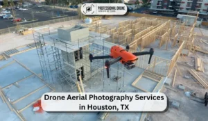
Commercial Drone Mapping & Inspection Services For Construction, Energy & Engineering Projects In Texas & Nationwide
Photogrammetry - 3D Orthomosaics - CAD Ready Deliverables - Thermal Roof Inspections - Construction Progress Documentation Trusted By Engineering Teams, Contractors & Asset Owners
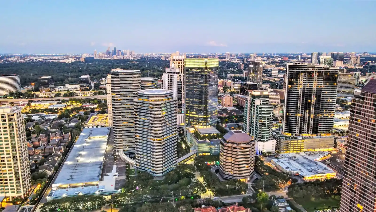
Drone aerial photography and video services provide high-resolution images and video used by commercial real estate, construction, and industrial teams to showcase assets, attract investors, and document project progress over time.
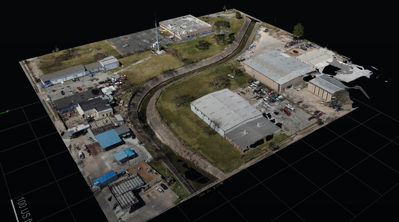
Drone mapping uses aerial data capture to generate accurate, survey-grade maps of large sites, helping construction and engineering teams reduce field time, improve accuracy, and streamline design and project workflows.
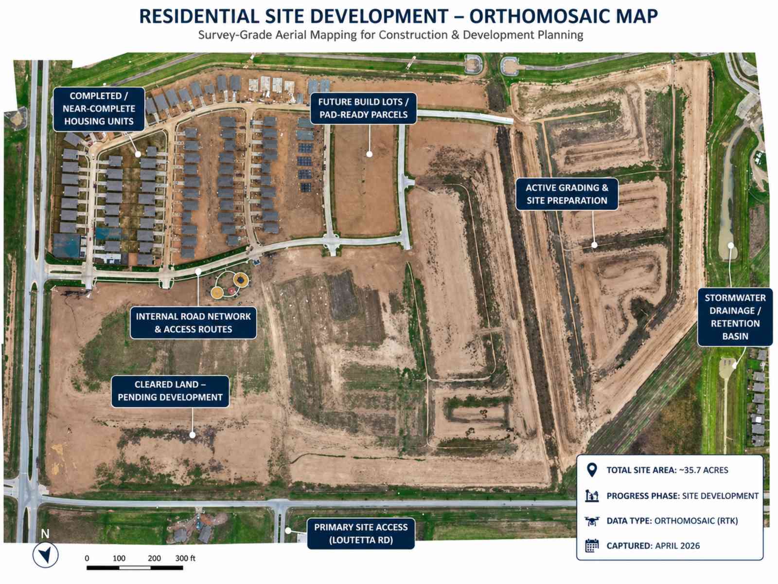
Drone mapping services for construction projects—capture accurate site data, track project progress, and verify contractor work with high-resolution aerial mapping that helps reduce delays and improve decision-making throughout the project lifecycle.
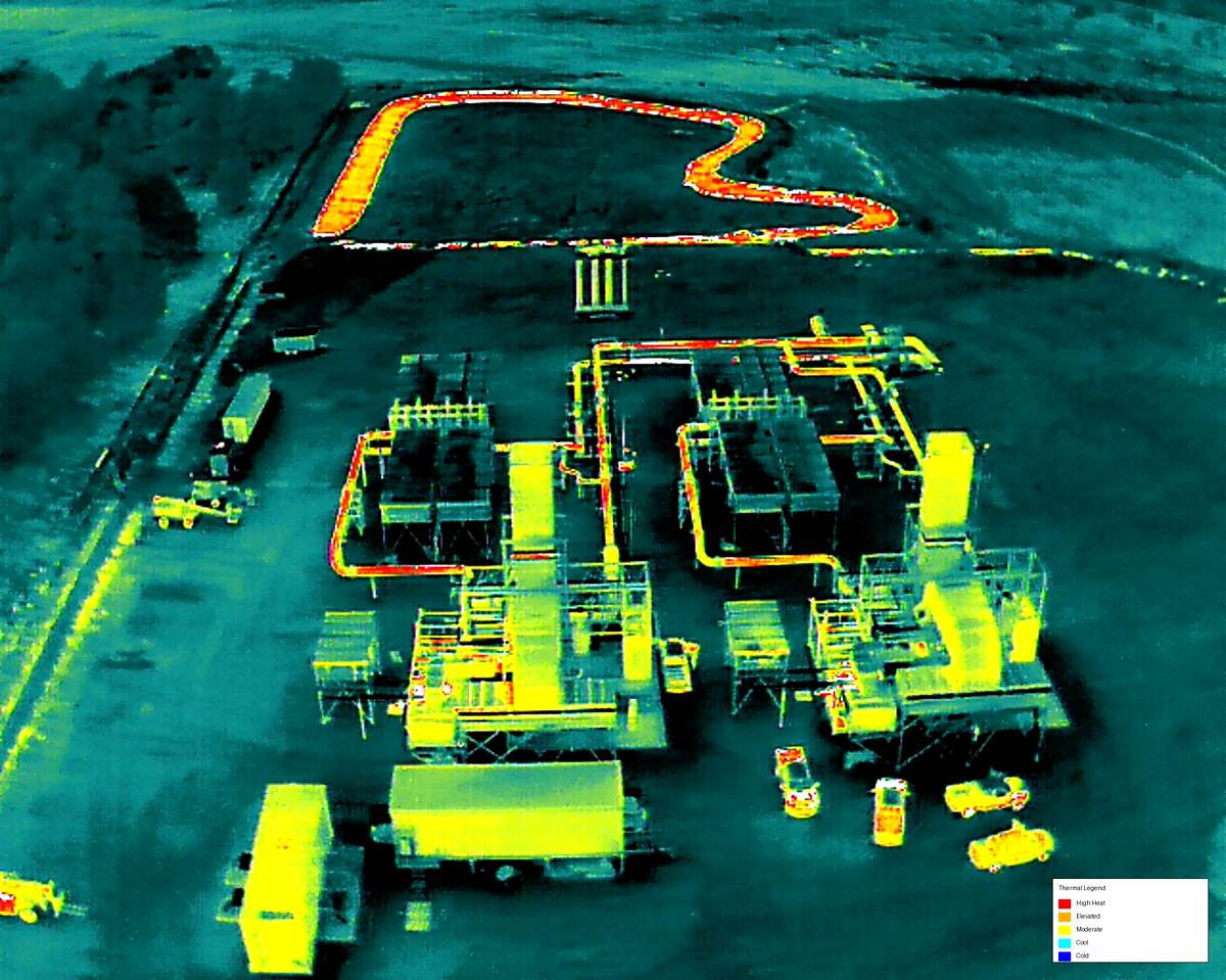
Drone thermal imaging services for roof inspections, electrical systems, and industrial assets—identify leaks, heat loss, and inefficiencies using high-resolution infrared drone inspections that deliver fast, accurate insights.
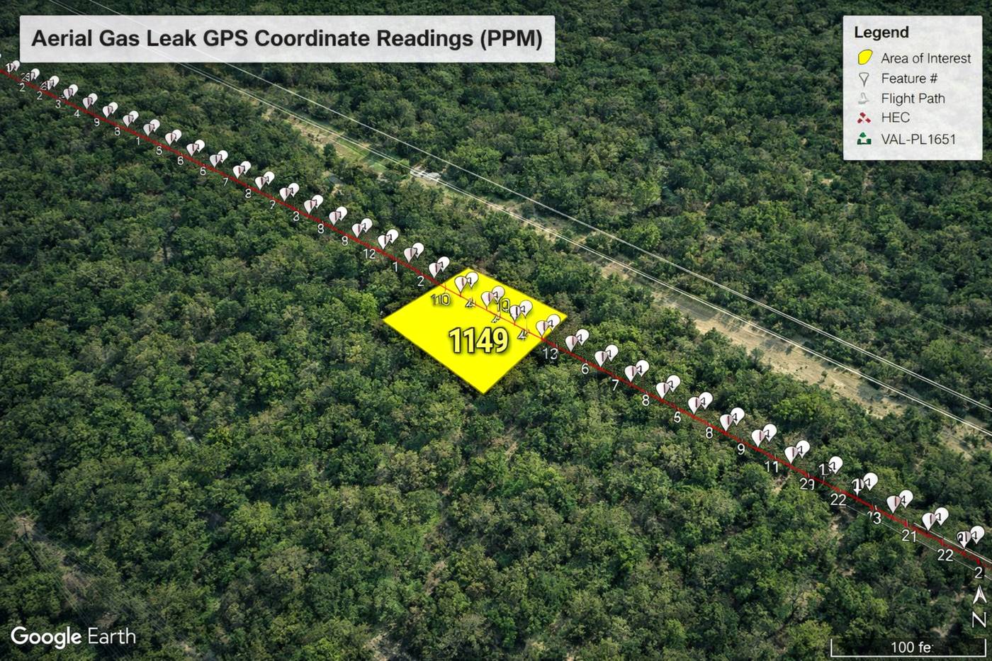
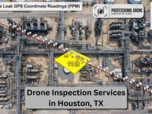
Drone methane detection services using advanced optical gas imaging (OGI)—locate gas leaks quickly, reduce emissions, and support regulatory compliance across pipelines, facilities, and industrial operations.


Professional Drone Services for Construction, Energy & Industrial Projects
Our commercial drone services deliver high-resolution aerial videography and photography for construction, oil & gas, energy, and industrial projects across Texas. We capture detailed drone footage that provides a clear, scalable view of complex job sites, equipment, and infrastructure—supporting project documentation, marketing, and operational visibility.
Reduce field visits, accelerate engineering decisions, verify contractor work, and document every phase of your project with survey-grade aerial data.
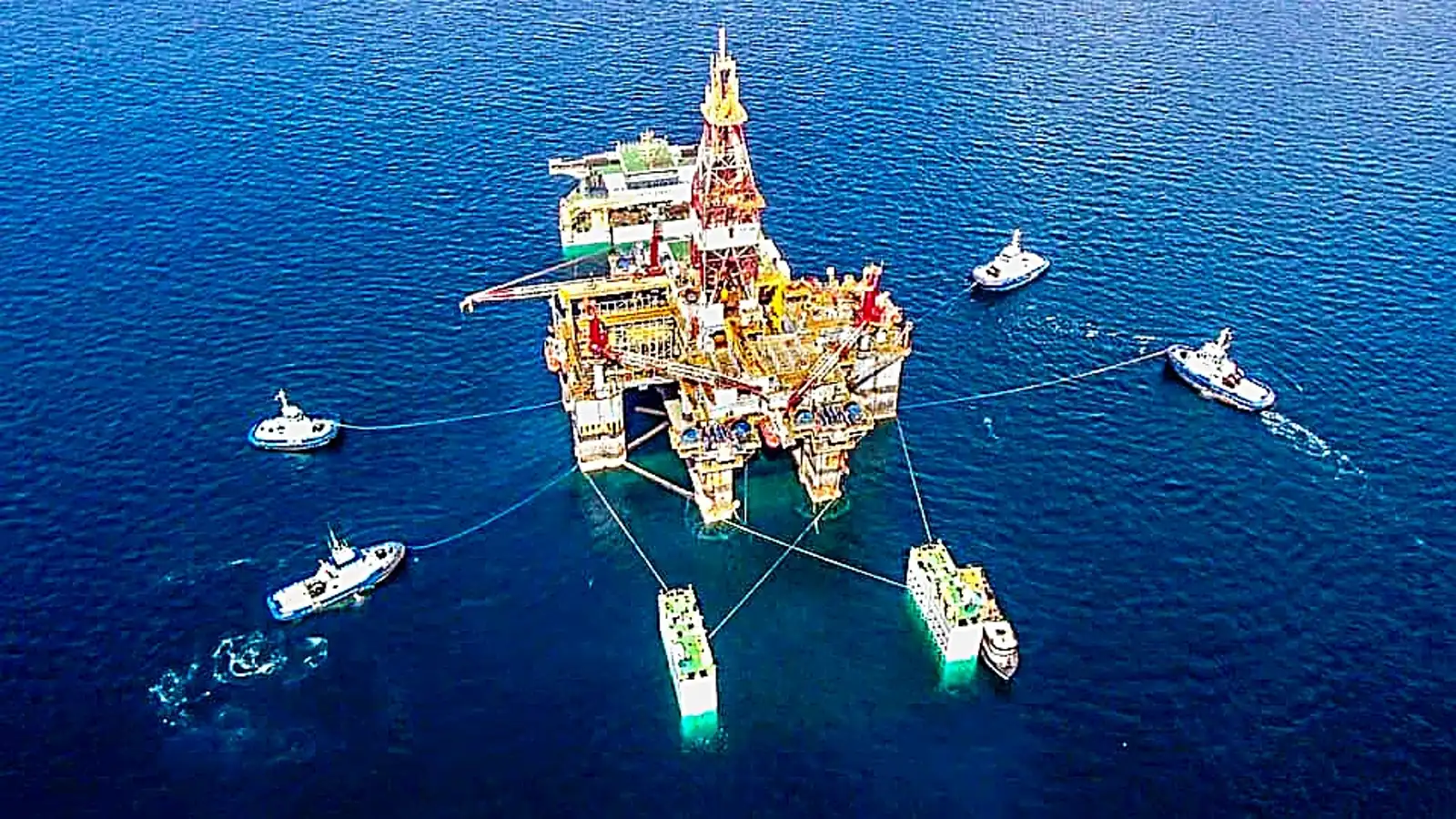
Our FAA-certified drone pilots specialize in filming high-value industrial environments, including oil and gas facilities, pipeline corridors, heavy lift operations, and large-scale infrastructure projects. Drone video improves communication, enhances safety documentation, and provides valuable visual data for project stakeholders.
- Crane lifts and heavy rigging operations
- Tank installations and structural placements
- Pipeline routing, inspection, and GPS corridor mapping
- Manufacturing facility tours and process documentation
- Construction progress monitoring and site updates
Talk to Pilot or Content Developer NOW!
(832) 856-8556
(832) 856-8556
Request A Project Quote
We typically respond within 30 minutes during business hours or call now for a quote
OUR LATEST DRONE VIDEOS
Heavy Lift & Equipment Highlights - Oil Rig Operations - Manufacturing Interior Tour - Pipeline GPS Location Services
Customer Reviews
Commercial Property & Site Intelligence
Need Aerial Real Estate Images & Video? Virtual Tours? Professional Drone Services of Texas delivers high-accuracy aerial data and visual intelligence for commercial properties and active job sites. From mapping and inspections to marketing visuals and structured reporting, we provide actionable deliverables your team can use to assess conditions, track progress, and make informed decisions with confidence.
.
Unprecedented Times Call For New and Innovative Product Offerings.